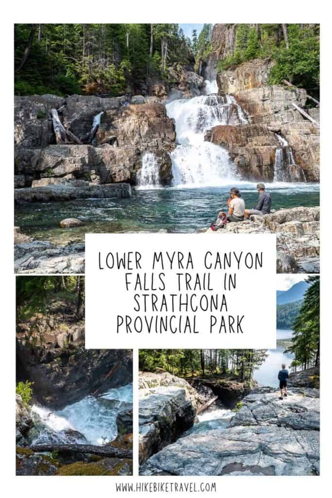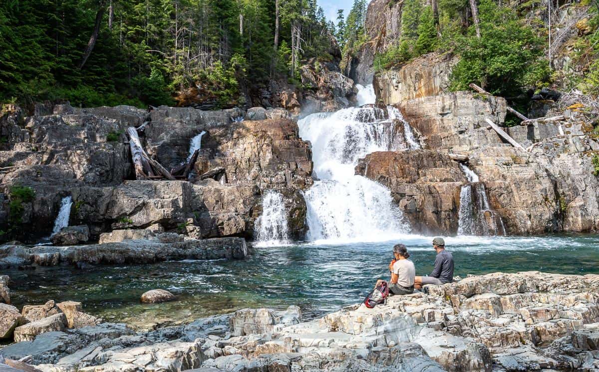
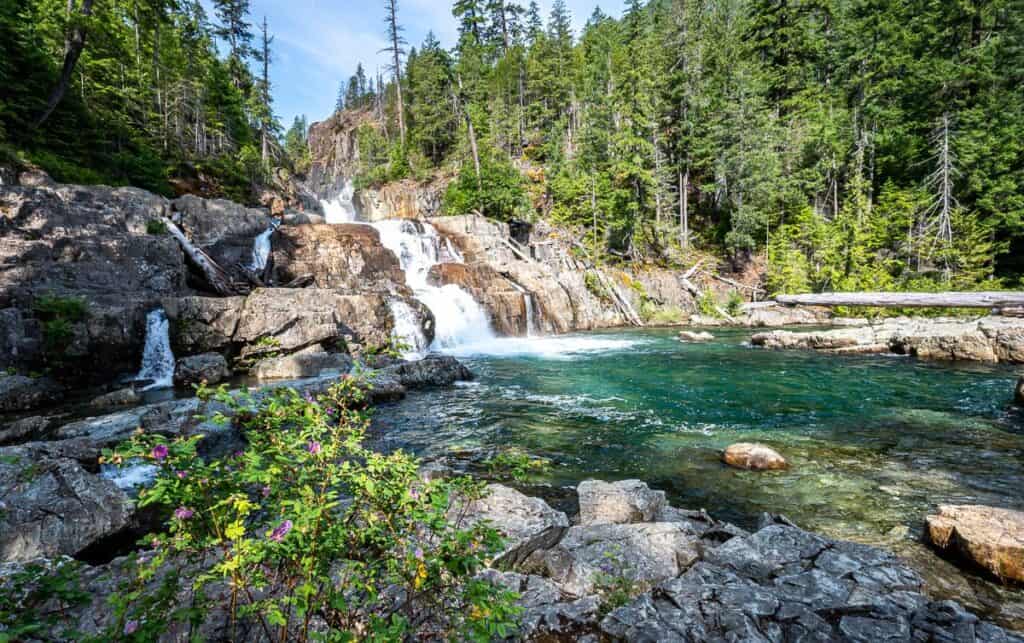
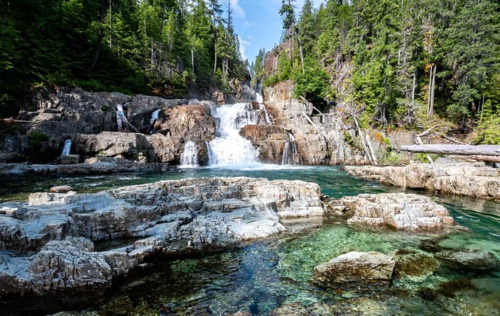
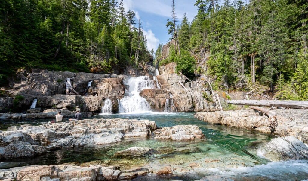
At the southern end of Strathcona Provincial Park on Vancouver Island, you’ll find one of the must do short hikes in British Columbia – Lower Myra Falls. This spectacular, family-friendly hike takes you to a multi-tired waterfall featuring teal-coloured pools in a beautiful, treed setting. You could spend and hour or two here simply watching the water cascade down through pools and narrow clefts to ultimately empty into Buttle Lake.
If you’re in Campbell River, camping on Buttle Lake, heading to Gold River – or perhaps even heading out on the multi-day Nookta Trail, it’s well worth the drive and short hike to see gorgeous Lower Myra Falls.
This post includes some affiliate links. If you make a qualifying purchase through one of these links, I will receive a small percentage of the sale at no extra cost to you. Thank you very much for your support.
 Apparently some people swim in the swimming hole out of the current but it’s bloody cold
Directions to Lower Myra Falls
Take Highway 28 West from Campbell River for 47 kilometres to reach a T-junction with Westmin Road (labeled Western Mine Road on Google Maps) at a bridge in Strathcona Provincial Park. Continue straight on Westmin Road for 40 km as it parallels Buttle Lake. Expect this part of the drive to take 45 – 60 minutes as the road has lots of waves and bumps in it so there will be times you need to slow down.
You’ll pass the trailheads for numerous hikes including Lupin Falls, Karst Creek, Auger Point and Flower Ridge as well as the Ralph River Campground.
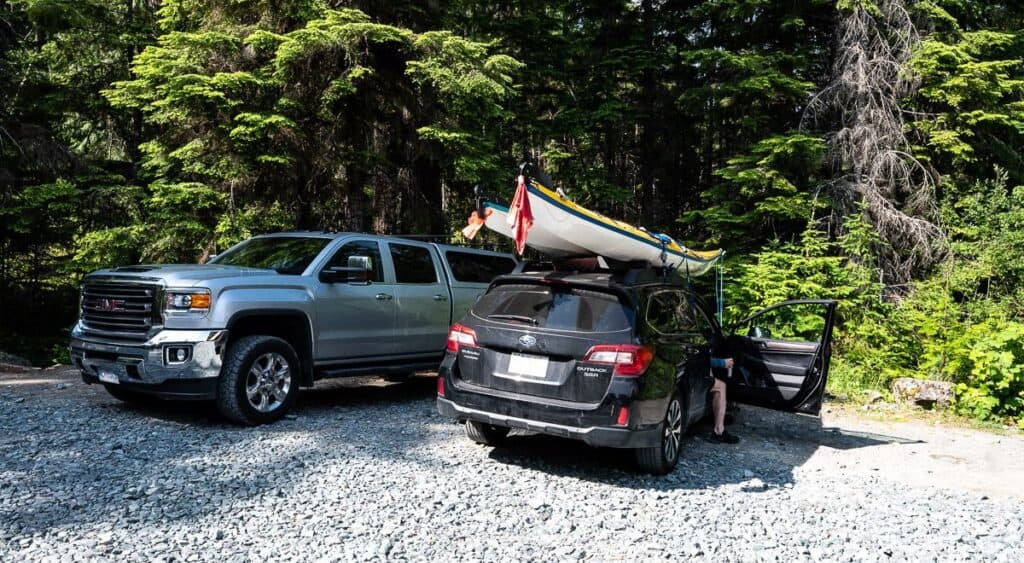
After you round the southern end of Buttle Lake, start looking for a short, steep gravel road off to your right signed for Lower Myra Falls. Take it to a smallish parking lot.
 A small parking lot is at the top of a short but steep gravel road
Location map of Lower Myra Falls
Trail map of Lower Myra Falls
 Map of the trail to Lower Myra Falls
Are Lower Myra Falls worth visiting?
Over breakfast at Strathcona Park Lodge, my husband and I were debating the pros and cons of visiting Lower Myra Falls in light of the fact we had to be back in Nanaimo to catch a ferry – and then still had two more hours of driving after that. We knew we’d be adding two extra hours of driving to the day.
After eating we met up with a family who had been the day before. They said “You must go. The area is so beautiful.” The long and the short of it is that we did – but we didn’t go for a chilly dip like the dad had done. And I would now say the same thing to anyone who asked me.
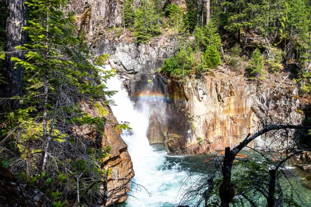
These waterfalls are quite literally some of the prettiest I’ve seen in Canada. It’s not often you find multi-tiered falls with turquoise-teal-coloured pools in such a setting. Visit. You won’t be disappointed.
 First view of the falls through the trees
How long is the Lower Myra Falls trail?
It’s an easy 1.0 km round trip hike with all loops included. There is an elevation loss of about 30 metres to get to the waterfalls.
If you’re short on time you could visit the falls and be back at the car in 30 or 40 minutes, but this is one waterfall where I recommend you linger.
 You can hike a loop trail to Lower Myra Falls
Lower Myra Falls stats and important information
Trail difficulty: Easy
Time needed: 45 minutes to 2 hours depending on how much time you want to lounge by the pools.
Best time to go: The falls are open year-round but are at their best during the spring melt when water volumes are high.
Dogs allowed: Yes, on a leash.
Please: This is a pristine area so practice the Leave No Trace principles – packing out everything you packed in.
Parking lot GPS coordinates: 49.57742966734707, -125.56557264516962
Don’t forget: Even though it’s a short an easy hike to Lower Myra Falls, I still recommend you pack the hiking essentials.
The waterfalls in motion: If you want to get a better idea of how beautiful the waterfalls are, check out my Lower Myra Falls Instagram reel.
 The falls are multi-tired and beautiful no matter where you stand
The hike to the waterfalls
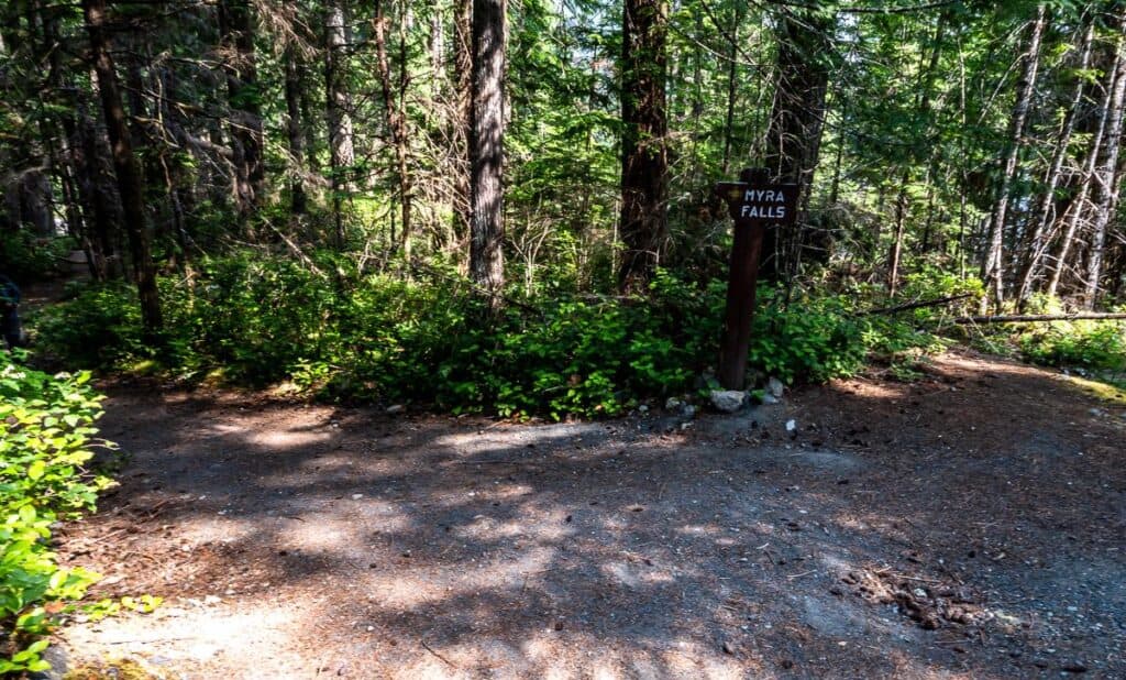
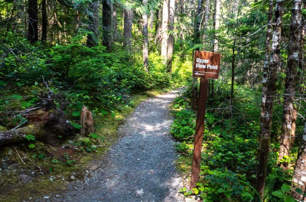
It’s a straightforward hike to Lower Myra Falls with no right or wrong way to do it. Leave the parking lot and start down steeply on a gravel road. The first sign you’ll see within about four minutes is the sign to the Upper View Point.
We did this part at the beginning of the hike and arrived in a couple of minutes at a concrete barrier. It was a good first look at Lower Myra Falls but the better view is from the bottom.
 There is some signage around
There is a well-defined trail from the top trail to part of the loop trail that goes to the falls. We took this passing some beautiful big western red cedars and western hemlocks on the way to the lower waterfalls.
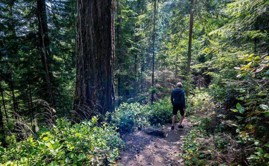 Enjoy some big trees on the way to Lower Myra Falls
All told, we spent about 40 minutes checking out the waterfalls from different angles – scrambling carefully over rocks to get a variety of views.
On the return we completed the loop. The final climb up to the parking lot isn’t long but it’s steep enough that you may need to stop and catch your breath.
 Lower Myra Falls on a sunny June day
 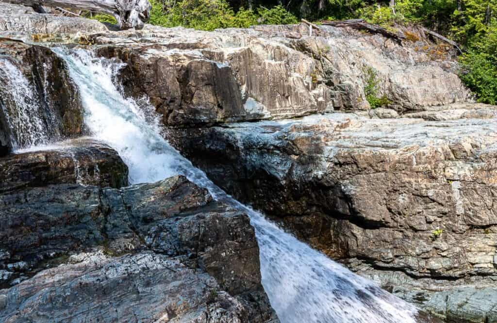 Fast moving water heading for Buttle Lake
 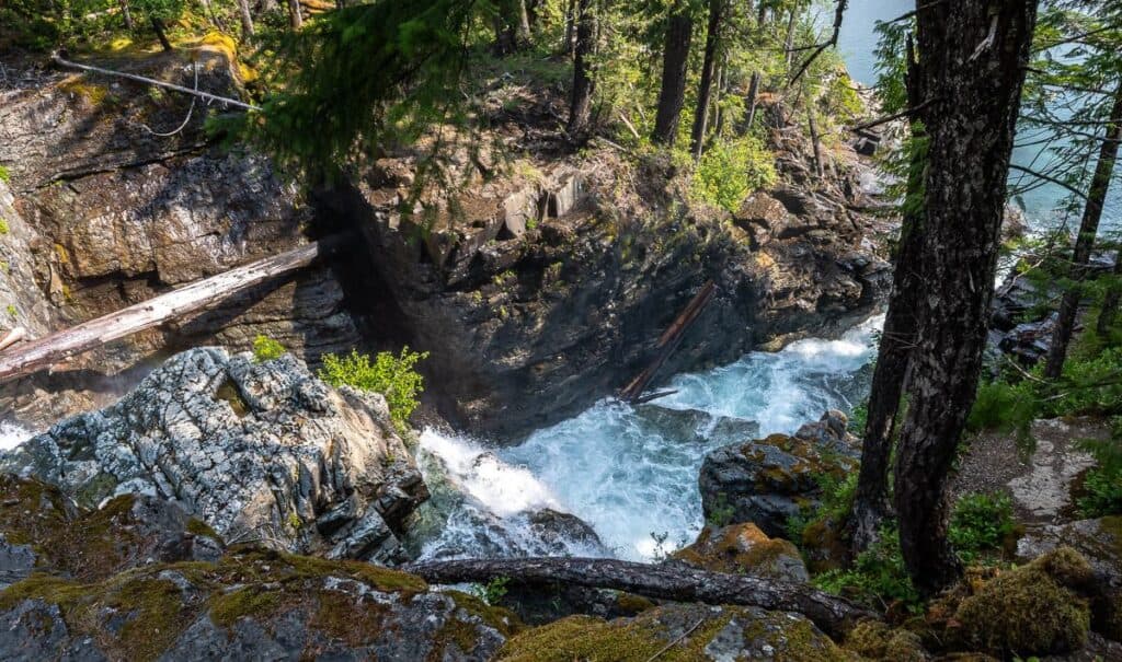 A more dramatic view of the falls as the water enters Buttle Lake
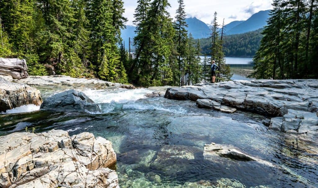
 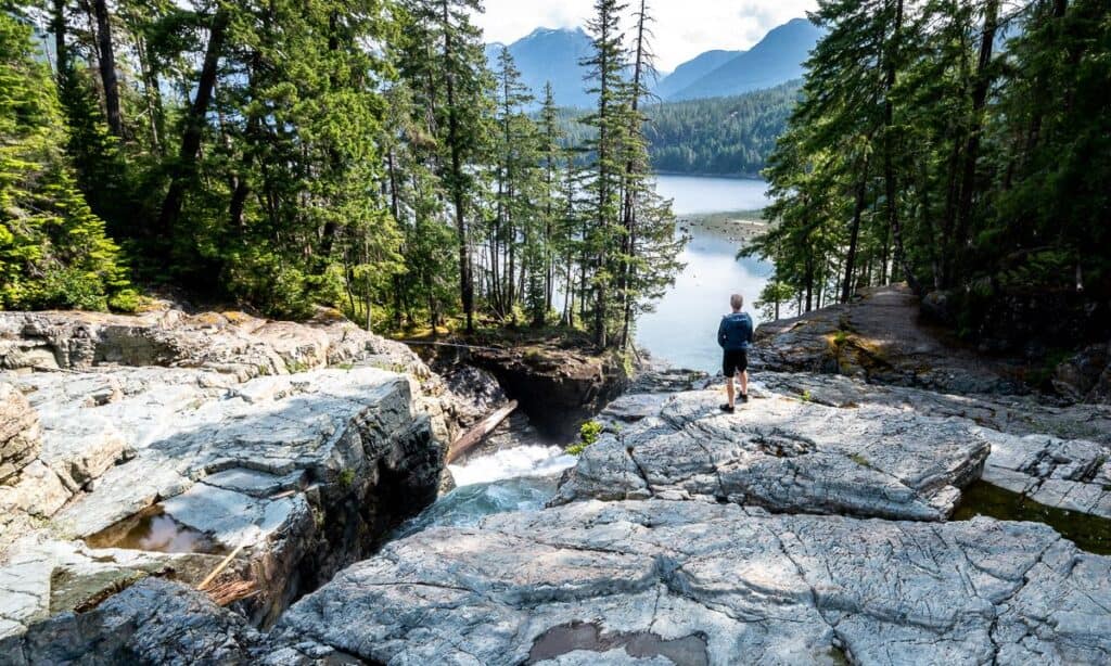 John admiring the view over Buttle Lake
Tips for visiting Lower Myra Falls
Safety should be a priority around the waterfalls. One slip, and the consequences could be dire. Do the following:
- Use common sense and stay back from the waterfalls. The wet rocks are very slippery.
- In summer go early or late in the day to avoid the crowds and parking headaches.
- Stay on the existing trails to prevent erosion.
- Don’t forget bug spray in summer.
- If you plan to go for a dip, be warned that the water is very cold. Stick to the pools away from the flow of the waterfall.
- Keep a close on your kids. I wouldn’t let go of their hand if they were little!
 One last look at these beautiful waterfalls before we start the drive home
Combine a visit to include other area attractions
There are numerous ways to extend your time in the area.
Nearby is 60-metre high Upper Myra Falls accessed via an 8 km round trip hike
If you drive towards Gold River, you’ll pass the Lady Falls parking area. It’s a short easy hike to reach the falls.
Canoeing or kayaking on Buttle Lake is scenic and fun, especially the area around the Buttle Lake Boat Launch.
You can camp at either the Ralph River Campground or the Buttle Lake Campground and both can be reserved online.
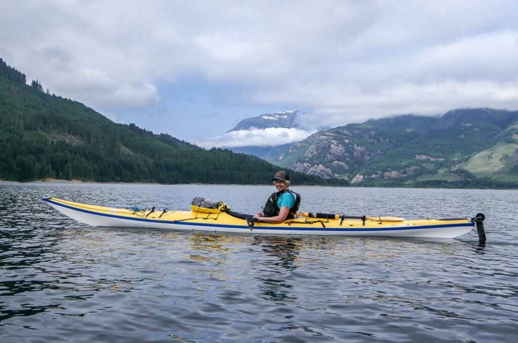 Kayaking from the launch site on Western Mine Road
FAQ’s
Can you swim at Lower Myra Falls? You can and people do, but please exercise caution and don’t go near any water with a current.
Is the trail open year-round? The road to the trailhead and the trail to the Lower Myra Falls is open year -ound but the best time to go is May to October.
Are dogs allowed on the trail? Dogs are allowed on a leash. Please pick up after them and dispose of their waste in a garbage can. Extra thick dog waste bags are useful on hikes.
Final thoughts
Lower Myra Falls is one of the top short hikes in BC. It over delivers in the scenery department and in my opinion delivers truly awe-inspiring scenery. It is well worth the effort to get there.
 Lower Myra Falls is one of the prettiest waterfalls I’ve ever seen in Canada
More hikes on Vancouver Island you’ll love
Click on the photo to bookmark to your Pinterest boards.